Verified Views
Cloud 9 Visualisation are a Architectural Visualisation studio, specialising in Verified Views. Verified Views, also known as Accurate Visual Representations are a vital part of Visual Impact Assessments which are produced to assist architects and developers to gain planning permission.
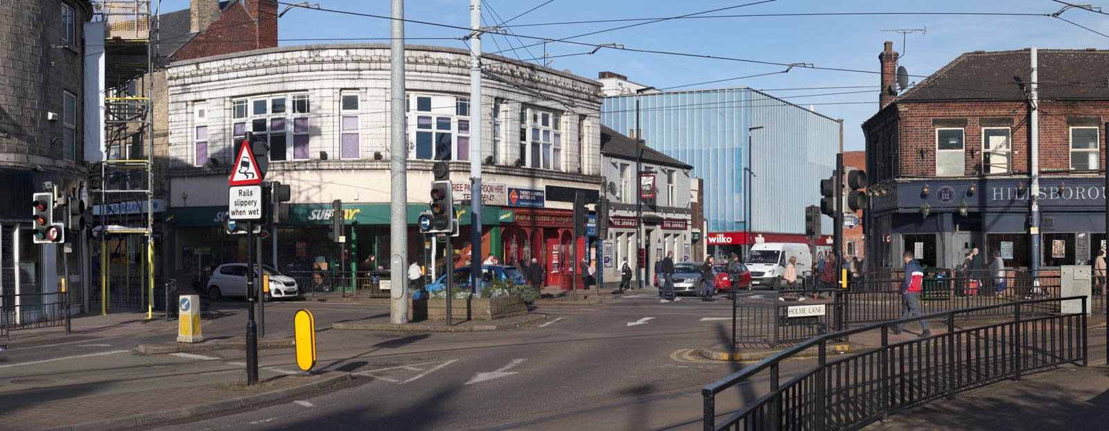
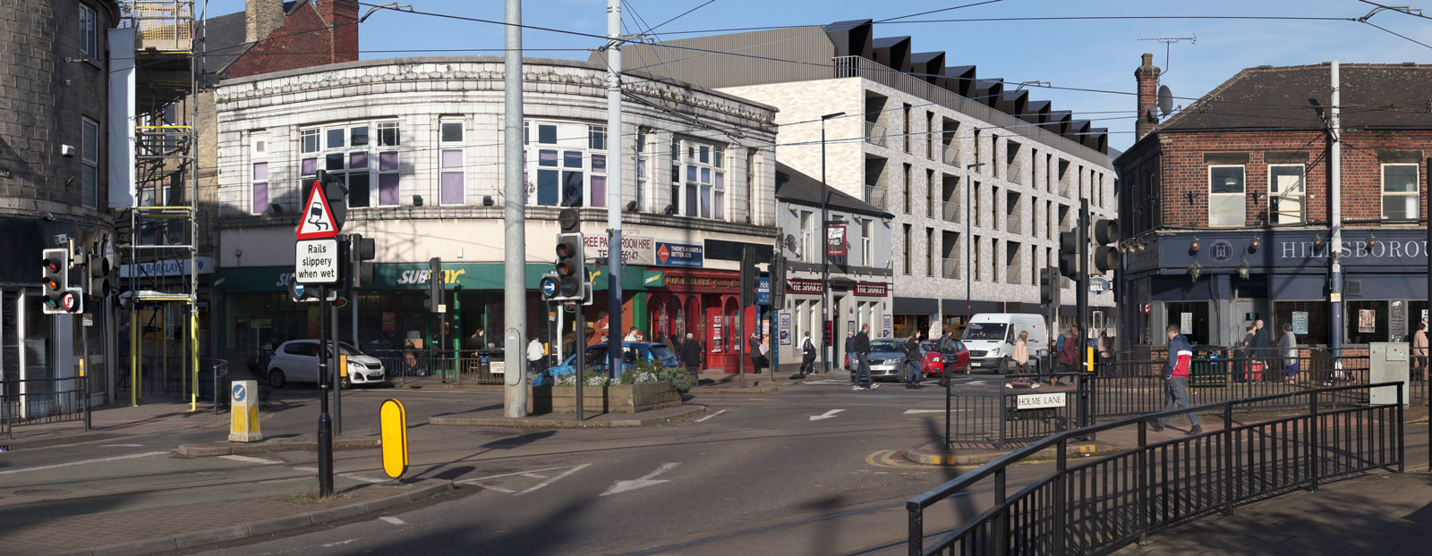
Helping to assess the Visual Impact of future developments, Verified Views are an integral part of successful planning applications, ensuring that proposed landscape and building schemes are represented as accurately as possible.
Typical turnaround: 10 working days
What we need from you:
Project brief
Proposed CAD drawings or 3D model
Existing CAD drawings, if available
Topographical survey
Finishes schedule & precedent photos
Planting schedule
How do verified views differ from photo montages?
Photomontages are computer generated images that have been montaged onto photography to show what a future development may look like. Many factors and variables mean that the accuracy of the finished visual can be questionable.
Verified views are superior to photo-montages, because they are created to a higher level of verifiable accuracy using survey data for photography, reference points and a strict recorded methodology which is integral in supporting planning applications.
This methodology and data is detailed in the supporting document that we produce to accompany any such views.
Accurate Visual Representations (AVR) classification (Levels of Detail)
When producing AVR’s the following classification types are presented to define the visual properties and impact within the surrounding area. These classifications levels can aid further design and planning decisions.
AVR – Existing Photography
AVR – Level 0 – Location and size of proposal
AVR – Level 1 – Location, size and degree of visibility of proposal
AVR – Level 2 – Description of Architectural form
AVR – Level 3 – Use of materials
Production process
Brief
Viewpoints are often provided by the client in the form of draft photographs. The location of the viewpoints are typically chosen through consultation with the local authority and require a visual impact assessment. All plans, elevations and material references are also provided.
Photography
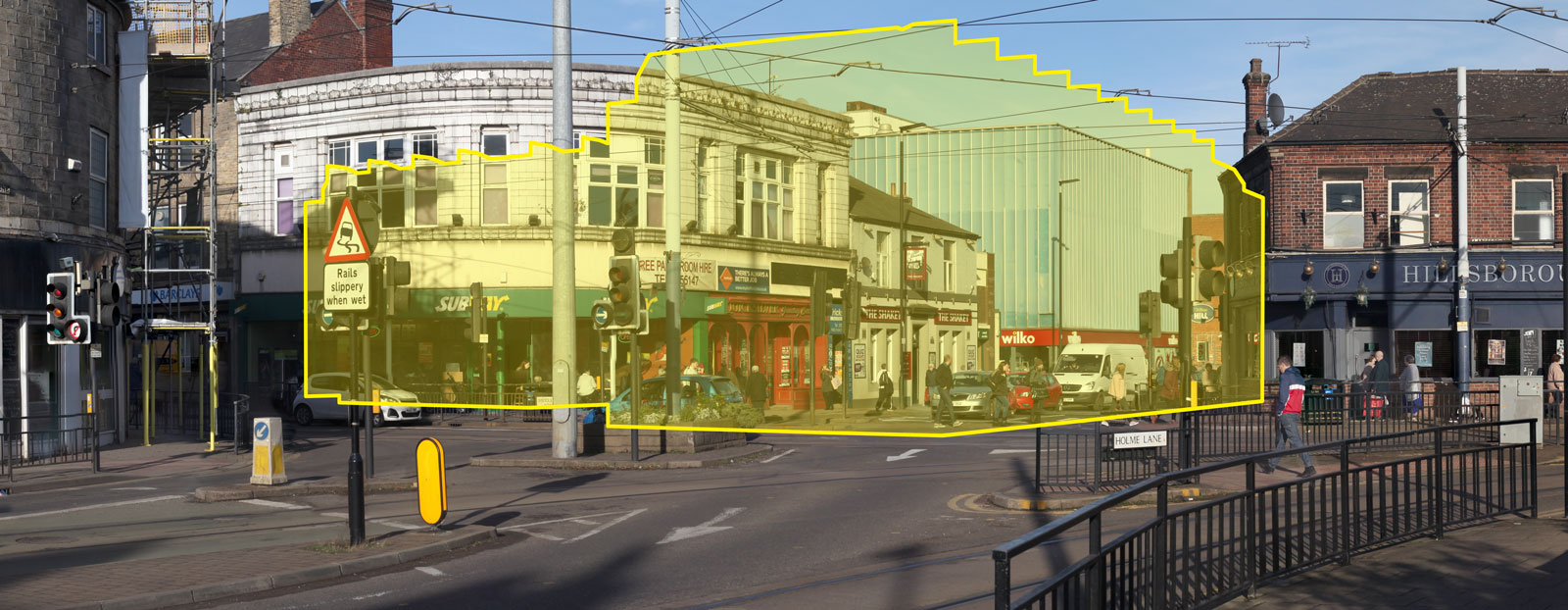
We take high resolution photography from each viewpoint and record a set of precise parameters including geographic location, elevation, heading, vertical position, lens focal length and sensor info.
Survey
Our surveyor visits the site to record a number of reference points within each viewpoint and also the camera locations to ensure a high level of accuracy.
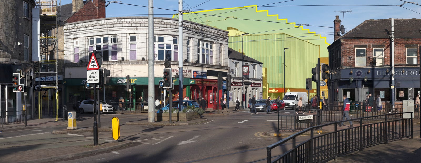
3D Model production
The 3D model of the proposed scheme is created using the plans & elevations provided by the client, the terrain is modelled using height data and any vegetation is also added.
Vegetation screening may be a required for a planning application, the landscape plan will be provided by the landscape architect which will show the location and species of plants/trees, we can then produce a 1yr, 5yr, 10yr or 15yr vegetation scenario for the required viewpoint.
Rendering process
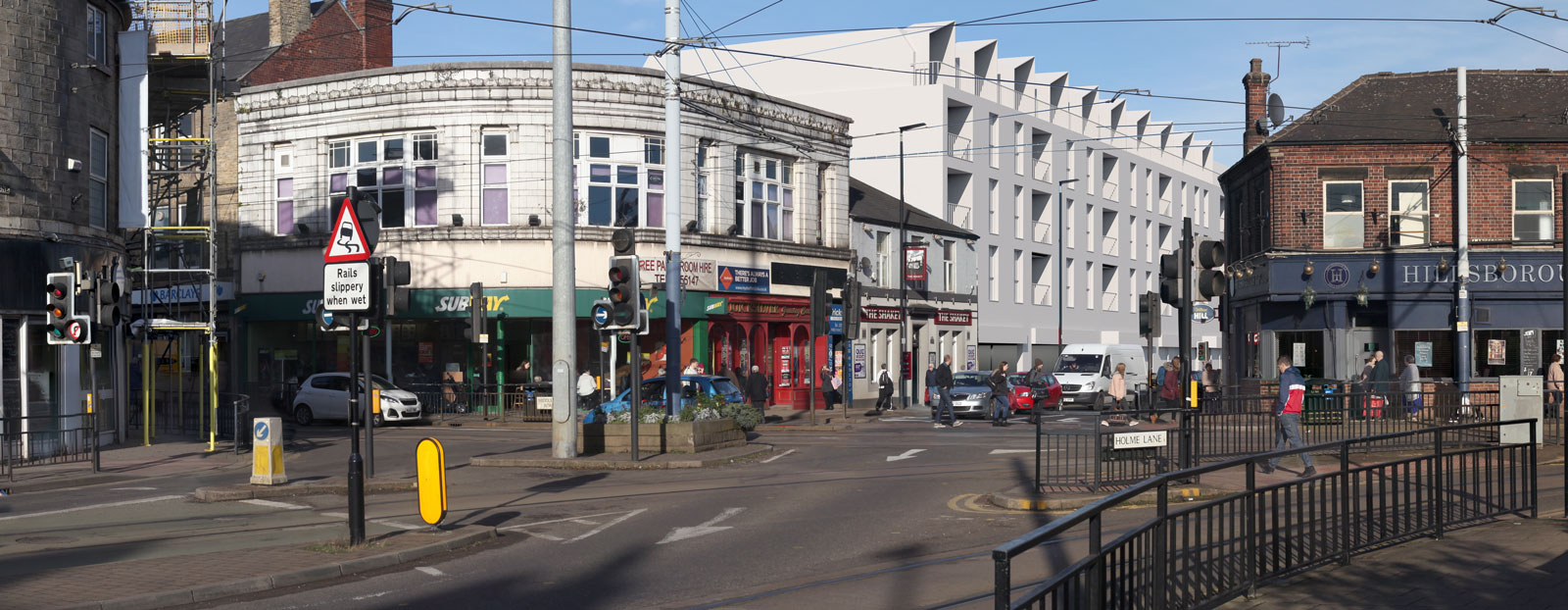
Lighting and Rendering
We set up the virtual cameras using the photography metadata and the survey data to match the perspective and location of the real-world camera positions. The lighting is then set up to match the lighting for each viewpoint.
Montage/Composite
The render is accurately composed onto the photography using advanced photo editing software, masking out any foreground elements.
Approval process & delivery
Once the AVRs are finalised, these will be sent for approval via email, any minor amendments can then be made before finalising, the final images will be released upon approval.
Documentation
The before and after views for each viewpoint are presented in a detailed document that also includes information on: viewpoint locations, camera and lens type for each view, survey data, and our overall methodology for the creation of the images.
Other names for verified views
Accurate visual representations (AVR)
Verified images
Visually verified montages (VVM)
Verified photo-montages
Certified views
Guidelines
The methodology we use accords with the following guidance documents where appropriate:
- The Third Edition of the good practice Guidelines for Landscape and Visual Impact Assessment 2013; produced by the Landscape Institute and Institute of Environmental Management & Assessment.
- Photography and photomontage in landscape and visual impact assessment Landscape Institute Advice Note 01/11. March 2011.
- Visual representation of development proposals Landscape Institute Technical Guidance Note 02/17 (31 March 2017)
- London View Management Framework Supplementary Planning Guidance: Appendix C: Accurate Visual Representations. March 2012.
Ready to Get Started?
We’d love to discuss your project
and send you a free, no obligation quote.